The Cost of Poor Fleet Management
Nigeria’s logistics and transportation sector loses an estimated ₦2.1 trillion annually due to inefficient fleet management and cargo theft. This data comes from the Nigerian Shippers’ Council. Yet companies implementing GPS tracking systems with IoT connectivity report significant improvements. They achieve 67% reduction in vehicle theft, 45% improvement in fuel efficiency, and 89% increase in delivery accuracy across challenging African network environments.
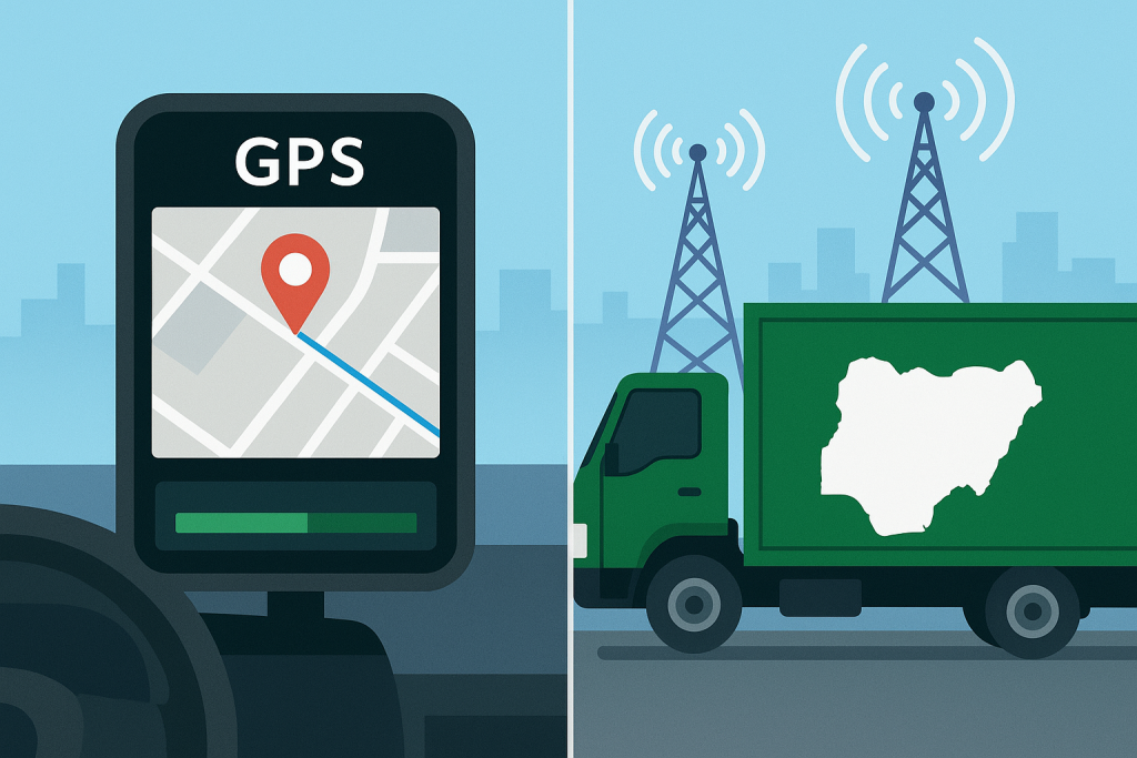
The secret lies in understanding how modern tracking systems leverage roaming SIMs and universal SIM technology. These systems maintain reliable connectivity across Nigeria’s diverse telecommunications landscape.
Connectivity Challenges Across Nigeria
From Lagos traffic congestion to remote northern delivery routes, Nigerian businesses require tracking solutions that function seamlessly. Network coverage variations shouldn’t interrupt monitoring capabilities. Traditional GPS devices often fail when moving between MTN, Airtel, Glo, and 9mobile coverage areas. This leaves critical assets unmonitored during vulnerable periods.
However, advanced tracking systems utilizing multinetwork SIM cards and sophisticated IoT connectivity protocols ensure continuous monitoring. They provide real-time location sharing even in Nigeria’s most challenging operational environments.
Complete Technology Guide
This comprehensive guide explores how tracking systems communicate with IoT SIMs. We’ll examine how they process GPS data and share location information across African telecommunications networks. Whether managing delivery fleets in Lagos, monitoring agricultural equipment in Kaduna, or tracking valuable cargo across interstate routes, understanding these technologies is crucial.
This knowledge enables Nigerian businesses to implement robust tracking solutions. These solutions deliver measurable operational improvements and cost savings.
1. Fundamentals of GPS Tracking Systems in Nigerian Networks
Core Technology Components
GPS tracking systems operate through a sophisticated integration of satellite positioning, cellular communication, and data processing technologies. These systems are specifically adapted for African network conditions. The Global Positioning System relies on satellites orbiting Earth to determine precise location coordinates. However, the real challenge lies in transmitting this data reliably across Nigeria’s complex telecommunications infrastructure.
Modern tracking devices contain GPS receivers that calculate location by measuring signals from multiple satellites simultaneously. GPS signals only provide location data – they cannot transmit this information to monitoring centers without cellular connectivity. This is where IoT connectivity becomes critical for Nigerian businesses operating across diverse network coverage areas.
GPS Data Processing
The tracking device’s GPS module continuously calculates coordinates using latitude, longitude, altitude, and timestamp data. This information is processed by the device’s internal microprocessor. The microprocessor formats the data for transmission through cellular networks. Nigerian tracking systems must account for signal interference from buildings in dense urban areas like Lagos and Abuja. They must also handle limited satellite visibility in heavily forested regions.
Power Management Considerations
Power management represents a crucial consideration for Nigerian deployments. Vehicles may operate for extended periods without engine power for charging. Modern tracking devices incorporate intelligent power management systems that balance GPS accuracy with battery conservation. This extends operational time during power outages or when vehicles are parked for extended periods.
Environmental Factors
Environmental factors unique to Nigeria include extreme temperatures, humidity, and dust exposure. These conditions require tracking devices with robust weatherproofing and temperature tolerance. Quality systems maintain operational integrity in temperatures ranging from 5°C to 65°C. They withstand moisture and dust ingress common in African operating conditions.
Signal Accuracy Challenges
Data accuracy depends on GPS signal quality. Signal quality can be affected by atmospheric conditions, urban canyon effects in city centers, and electromagnetic interference from industrial equipment. Nigerian tracking systems incorporate error correction algorithms and multi-constellation support. They use GPS, GLONASS, and Galileo systems to maintain positioning accuracy even under challenging signal conditions.
2. How IoT SIMs Enable Reliable Tracking Communication
IoT Connectivity Transformation
IoT connectivity transforms GPS coordinates into actionable business intelligence through sophisticated cellular communication protocols. These protocols are designed for machine-to-machine data transmission. Unlike consumer mobile devices, tracking systems require specialized IoT SIMs. These SIMs are optimized for small, frequent data transmissions and extended operational lifecycles across challenging network environments.
Universal SIM Technology Benefits
Universal SIM technology proves essential for Nigerian tracking applications. It enables automatic switching between network operators based on signal strength and data costs. When a tracking device moves from an area with strong MTN coverage to a region where Airtel provides better service, the universal SIM seamlessly transitions. This happens without losing connectivity or requiring manual intervention.
Communication Process Flow
The communication process begins when the tracking device’s GPS module calculates location coordinates. This data is packaged into standardized protocols such as TCP/IP or UDP packets. The packet includes device identification, timestamp, location coordinates, speed, direction, and additional sensor data like fuel levels or door status. The IoT SIM then transmits this data package through the strongest available cellular network.
Roaming SIM Advantages
Roaming SIMs provide particular advantages for Nigerian businesses operating across multiple states or international borders. Traditional SIMs tied to single network operators may lose connectivity when vehicles travel outside their home network coverage area. Roaming SIMs maintain connectivity by automatically accessing partner networks. This ensures continuous tracking coverage across West Africa.
Data Compression Techniques
Data compression techniques minimize transmission costs while maintaining data integrity. Tracking systems can transmit location updates using as little as 50-100 bytes per transmission. This makes continuous monitoring cost-effective even for large fleets. Advanced systems implement intelligent reporting intervals. They increase transmission frequency during movement while reducing updates when vehicles are stationary.
Network Selection Intelligence
Multinetwork SIM cards enable tracking systems to compare network performance in real-time. They automatically select the carrier providing optimal signal quality and data transmission speeds. This capability proves particularly valuable in Nigeria’s varied terrain. Network coverage can change dramatically over short distances due to geographical features and infrastructure variations.
3. GPRS Data Transmission Architecture for African Networks
GPRS Foundation Technology
General Packet Radio Service (GPRS) forms the backbone of tracking system communication across African telecommunications networks. GPRS provides packet-switched data transmission optimized for small, frequent data exchanges typical of tracking applications. This technology enables tracking devices to maintain always-on connectivity while minimizing power consumption and data costs.
GPRS Transmission Process
The GPRS transmission process begins when tracking devices establish data sessions with cellular networks. Unlike voice calls that require dedicated circuit connections, GPRS creates packet-based connections. These connections efficiently share network resources among multiple devices. This approach proves particularly effective for tracking applications that transmit small amounts of data frequently rather than large files occasionally.
Nigerian Network Specifications
Nigerian tracking systems utilize GPRS Class 10 or higher specifications. These support data transmission speeds of 32-48 kbps sufficient for real-time location updates. They maintain compatibility with older network infrastructure common in rural areas. Higher-speed 3G and 4G LTE connections provide enhanced performance in urban areas. GPRS ensures connectivity in regions with limited network infrastructure.
Data Packet Structure
Data packet structure includes essential tracking information organized into standardized formats. These formats are compatible with various tracking platforms and fleet management systems. Each packet contains device identifier, GPS coordinates, timestamp, speed, heading, and status information. This information is compressed into efficient data structures minimizing transmission overhead and costs.
Network Failover Protocols
Network failover protocols ensure continuous connectivity when primary GPRS connections encounter issues. Tracking devices automatically attempt reconnection through alternative network operators or different connection protocols. This prevents data loss during network maintenance or coverage gaps common in African telecommunications infrastructure.
Quality of Service Management
Quality of Service (QoS) management prioritizes tracking data transmission during network congestion. This ensures location updates reach monitoring centers even during peak usage periods in major Nigerian cities. Advanced tracking systems negotiate appropriate QoS levels with cellular networks. They balance transmission reliability with cost considerations.
4. Real-Time Location Sharing and Data Processing Systems
Data Processing Pipeline
Location sharing transforms raw GPS coordinates into actionable business intelligence through sophisticated data processing platforms. These platforms are designed for African market requirements. These systems receive location data from tracking devices, process it through analytical algorithms, and present information through user-friendly interfaces. These interfaces are accessible via web browsers and mobile applications.
The data processing pipeline begins when tracking servers receive GPS packets from IoT SIMs across various network operators. Incoming data undergoes validation checks ensuring coordinate accuracy, timestamp integrity, and device authentication. Invalid or suspicious data packets are flagged for manual review while verified information proceeds through automated processing workflows.
Geofencing Capabilities
Geofencing capabilities enable Nigerian businesses to define virtual boundaries around specific locations. The system automatically generates alerts when tracked assets enter or exit designated areas. This functionality proves particularly valuable for delivery route compliance, restricted area monitoring, and theft prevention across Nigeria’s complex geographical and security landscape.
Real-Time Mapping Integration
Real-time mapping integration displays vehicle locations on interactive maps including Nigerian road networks, traffic conditions, and geographical features. Advanced platforms incorporate local mapping data showing detailed street layouts in major cities like Lagos, Abuja, and Port Harcourt. They provide accurate navigation information for rural areas often poorly represented in international mapping services.
Historical Data Analysis
Historical tracking data enables comprehensive route analysis. This identifies patterns in vehicle usage, driver behavior, and operational efficiency. Nigerian businesses utilize this information for route optimization, fuel consumption analysis, and performance improvement initiatives. These initiatives can reduce operational costs by 15-25% annually.
Alert and Notification Systems
Alert systems monitor tracking data for predefined conditions. These include speeding, unauthorized usage, maintenance requirements, or security breaches. Customizable notification systems deliver alerts through SMS, email, or mobile app push notifications. This ensures appropriate personnel receive timely information regardless of their location or available communication methods.
5. Network Coverage and Connectivity Challenges in Nigeria
Coverage Variations Across Nigeria
Nigeria’s telecommunications landscape presents unique challenges for tracking system deployment. Solutions must account for varying network coverage, infrastructure limitations, and geographical diversity. Understanding these challenges enables businesses to implement tracking systems that maintain reliable performance across different operational environments.
Network coverage varies significantly between urban and rural areas. Major cities like Lagos, Abuja, and Port Harcourt enjoy comprehensive 4G LTE coverage. Remote areas may rely on 2G and 3G networks. Tracking systems must support multiple network technologies. They must automatically adapt to available connectivity options without losing functionality or data transmission capabilities.
Infrastructure Limitations
Infrastructure challenges include power supply inconsistencies affecting cell tower operations. This particularly occurs during rainy seasons when power outages become frequent. Tracking systems utilizing universal SIM technology can automatically switch between network operators. This maintains connectivity even when specific towers experience power-related service interruptions.
Topographical Impact
Topographical factors significantly impact network coverage. Nigeria’s diverse landscape includes coastal plains, forest regions, plateaus, and mountainous areas. Each presents different connectivity challenges. Tracking devices require sensitive antennas and intelligent signal management to maintain communication across these varied terrains.
Network Congestion Issues
Network congestion during peak hours in major Nigerian cities can affect data transmission speeds and reliability. Advanced tracking systems implement data buffering and retry mechanisms. These ensure location updates eventually reach monitoring servers even during periods of network congestion or temporary connectivity loss.
Cross-Border Tracking
Cross-border tracking for businesses operating across West African markets requires roaming capabilities and international network partnerships. Universal SIM solutions provide seamless connectivity when vehicles travel between Nigeria, Ghana, Benin, and other regional markets. This eliminates the need for separate tracking systems for each country.
Cost Optimization Strategies
Cost optimization becomes critical given Nigeria’s relatively high data costs compared to developed markets. Efficient tracking systems implement data compression, intelligent reporting intervals, and network selection algorithms. These minimize connectivity expenses while maintaining required monitoring capabilities and data accuracy.
6. Advanced Features and Integration Capabilities
Comprehensive Fleet Management
Modern tracking systems extend beyond basic location monitoring to provide comprehensive fleet management and asset protection capabilities. These systems are specifically designed for Nigerian market requirements. They integrate multiple sensors and communication protocols to deliver complete operational visibility and control.
Sensor Integration
Advanced tracking systems incorporate multiple sensor types including fuel level monitors, temperature sensors, door status indicators, and driver behavior analyzers. These sensors transmit data through the same IoT SIM connectivity used for GPS tracking. This creates comprehensive monitoring ecosystems that provide detailed operational insights.
Fleet Analytics Platform
Fleet analytics platforms process tracking data to generate actionable business intelligence. These platforms identify inefficiencies, predict maintenance requirements, and optimize operational performance. Nigerian businesses use these insights to reduce fuel consumption, improve driver safety, and enhance customer service delivery.
Mobile Application Integration
Mobile applications provide fleet managers and drivers with real-time access to tracking information. These applications work across Nigerian mobile networks and support offline functionality when connectivity is limited. Push notifications alert users to important events while detailed reporting enables performance analysis and improvement planning.
Third-Party System Integration
Modern tracking systems integrate with existing business software including accounting systems, customer relationship management platforms, and supply chain management applications. API connectivity enables automated data sharing and workflow integration. This reduces manual data entry while improving operational efficiency and accuracy.
Maintenance and Support
Ongoing maintenance and technical support prove critical for tracking system success in Nigerian environments. Local support capabilities ensure rapid response to technical issues. Regular system updates maintain compatibility with evolving network technologies and security requirements.
Conclusion: Implementing Successful Tracking Solutions
Technology Integration Success
Successful tracking system implementation requires understanding the complex interaction between GPS technology, IoT SIMs, and Nigerian telecommunications infrastructure. Businesses that invest in comprehensive tracking solutions with universal SIM connectivity achieve significant operational improvements. These include reduced theft, improved efficiency, and enhanced customer satisfaction.
Strategic Planning Requirements
Implementation success depends on careful planning that considers network coverage, cost optimization, and integration requirements. Partner selection is crucial – choose providers with proven experience in Nigerian markets and comprehensive technical support capabilities.
Future-Proofing Considerations
As Nigeria’s telecommunications infrastructure continues evolving with 5G deployment and improved network coverage, tracking systems must adapt to leverage new capabilities. Investment in flexible, upgradeable systems ensures long-term value and continued operational advantages.
Next Steps for Implementation
Ready to implement advanced tracking solutions for your Nigerian operations? Contact GenYZ Solutions for comprehensive consultation on IoT connectivity, universal SIM deployment, and tracking system integration. Our team of African connectivity specialists will design customized solutions that deliver measurable results across your entire operational footprint.